Hike the Carters !
Saturday, Aug 06, 2022 9:00a -
5:00p
Where:
Sullivan Square
Sullivan Square(Medford Street / The Neck, Boston, MA, USA)
Boston, MA 02129
Admission:
Unknown
Categories:
Meetup, Social Good, Sports & Active Life
Event website:
https://p.ridj-it.com/app/trip-detail?id=96845
NOTE: This is not a beginner's hike. If we havnt hiked together before OR your Ridj-it profile is bare please write in some of your past experience before signing up for the trip. Thanks!
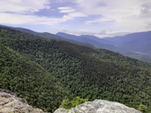
Welcome to another hike in the Whites! We will bag 3 NH48 peaks, Carter Dome, South Carter and Middle Carter on this hike. We will take the steep Imp path up from Rt 16 to first hit Imp face cliff for some epic views! From there we will take North Carter trail to reach the ridgeline thus ending the largest chuck of climbing for the day. From there we will turn right heading South to first summit Middle Carter followed by South Carter. While both summits are wooded, there are pretty sweet lookout points with expansive views of the Wild River Wilderness and the Baldface Range on your left and the Presidentials on your right. From South Carter we will head down to the Zeta Pass followed by another moderate climb to Mt. Hight which will be more than made up for by the great 360 views from its bald summit. From there we will take the Carter Moriah trail to hit the highest and the last peak of the day, Carter Dome. While again being wooded there are also lookout point around Carter Dome with nice views of Carter Notch and the Wildcats, right across. We will continue down the Carter Moriah trail to Carter Notch and hike back out to Rt16 by the 19 mile brook trail.
Note, that we will need to do a bit of car spotting as there are 1.48 miles between the start and end of this route or we can just walk back. Either is fine by me.
Length: 12.5 miles
Elevation gain: 4744 ft
difficulty: Hard
Gear:
Trail runners or hiking boots with god traction (NO SNEAKERS! you will be left behind at Alewife if you come in sneakers. )
Non-cotton layers
Outer shell + hood for the rain/wind
2-3 liters of water
trekking poles (highly recommended)
Hat
Snacks/ lunch
Electrolytes! (highly recommended)
A sunny disposition (MANDATORY)
a map of the trail (mandatory)
first aid (ibuprofen, band aids, compression straps etc)
Masks for social distancing
Map:
Expectations:
A happy bunch of people who know what they are getting into and are ready to push themselves physically and psychologically. As always a sunny, dry day with the views stretching beyond the horizons and in our minds into the week that follows. Happy hiking!
-

Sponsored -

SponsoredAffordable Spanish Classes in Boston (in-person and online courses) | BASE
Monday, May 05, 2025 goes until 05/18
Boston Area Spanish Exchange (BASE)
-

SponsoredSMALL ⭐ MART | Vintage, Vinyl & Art Night Market at Crystal Ballroom
Friday, Apr 04, 2025 5:00p
Crystal Ballroom at Somerville Theatre
-

SponsoredTrillium VIP Brewery/Distillery Tour & Tasting- Transportation from Boston Included- 15% Off!
Saturday, Apr 05, 2025 12:00p
Trillium Flagship


